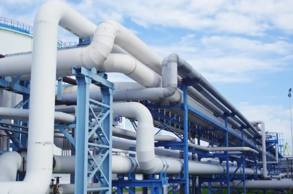
City programs and infrastructure operators are under the same pressure from several directions: ageing assets, climate-driven troubles, increasing maintenance costs, and the hardship to prove performance with data. In many pilots and large-scale reconstruction efforts, leaders are finding that spatial visibility, which is the fastest path to operational clarity. That’s the reason that a Geospatial Digital Twin is gaining traction, because it joins “where things are” with “what’s happening now,” helping teams decrease field visits, isolate faults quickly, prioritize CAPEX smarter, and prevent costly failures.
What a Geospatial Digital Twin Really Is
A Geospatial Digital Twin is a live, map-based digital depiction of infrastructure assets and networks that stay updated with real data. Unlike a static map or a one-time model, it:
- links up assets to geographic location (roads, pipes, valves, culverts, substations, buildings)
- adds up real-time and historical performance (IoT/SCADA signals, inspections, maintenance history)
- supports in analysis and decision workflows (risk scoring, routing, outage impact, work orders)
Take it as “GIS + live operations + decision logic.” It’s particularly useful for networks and corridors where location and connectivity establish cost and risk.
GIS Digital Twin Basics: Layers, Networks, and Live Data
A GIS digital twin starts with the basics of GIS: layers, topology, and spatial analysis—then adds live data and operational workflows.
GIS Layers
GIS stores information in multiple layers such as:
- asset layers (pipes, manholes, pumps, bridges, streetlights)
- administrative layers (districts, wards, service zones)
- environmental layers (terrain, flood zones, land use)
- incidents layers (complaints, work orders, outages, incidents)
A strong GIS digital twin keeps these layers reliable with a shared asset ID structure.
Networks and Topology
Infrastructure isn’t just points on a map. Networks have direction and dependences:
- water networks: pressure zones, valves, and direction of flow
- drainage: catchments, culverts, and outlets
- power corridors: feeders, substations, and switching devices
- roads: intersections, restrictions, and detours
This is the network logic that makes digital twin in GIS valuable: you can track impact, simulate isolation, and predict downstream outcomes.
Live Data
A GIS digital twin becomes “alive” when it connects time-series and event streams:
- IoT sensors (pressure, flow, level, vibration, temperature)
- SCADA signals (alarms, setpoints, pump status)
- mobile inspection data (condition scores, photos, notes)
- weather feeds (rainfall intensity, heat alerts)
- citizen reports (location-tagged complaints)
What Is a Digital Twin GIS?
If you’re looking for “what a digital twin GIS is”, here’s the right answer:
A “digital twin GIS” is a digital twin that is built on GIS foundations, where spatial layers and network topology are the core model, and live operational data updates the map to support in decision making.
Examples of a Digital Twin GIS in Practice
- Water utility: pressure sensors update a map; the twin emphasizes anomaly clusters, suggests valve isolation zones, and generates work orders.
- Flood management: rainfall and level sensors update risk layers; the twin predicts hotspots, routes response teams, and status of tracks closure.
- Power corridor: feeder events and device status update a network map; the twin highlights affected customers, switching options, and restoration progress.
In each case, GIS is not “only visualization.” The GIS structure is the operating context which determines cost and impact.
Key Components and Technologies Behind a GIS Digital Twin
A GIS digital twin is a system, not an isolated single tool. These are the core components that are important for infrastructure.
1) Data Sources
- GIS data: asset layers, topology, zones, land use
- BIM data: detailed building/structure information (useful for facilities and complex assets)
- IoT/SCADA: real-time telemetry and alarms
- LiDAR / DEM: terrain and elevation models for drainage and flood behavior
- Drones / satellite: change detection, condition monitoring, corridor surveys
- Maintenance records: CMMS/EAM work history, parts, labor time
- Inspections: condition ratings and defect logs
2) Integration and Data Pipelines
To keep the twin current, you require:
- APIs to ingest SCADA and IoT telemetry
- ETL/ELT pipelines to clean, normalize, and align timestamps
- Asset IDs that match across systems (GIS ↔ CMMS ↔ SCADA ↔ BIM)
- Time-series storage for sensor data and events
- governance rules for “source of truth” and change control
3) Analytics
A geospatial twin supports:
- spatial clustering (hotspot detection)
- network tracing (upstream/downstream impact)
- routing and dispatch optimization
- risk mapping (likelihood × consequence)
- Prioritization scoring for renewals and maintenance
4) Dashboards and Workflows
High-value workflows comprise:
- alarm → triage → work order → closure loop
- outage impact visualization (customers, zones, facilities)
- preventive maintenance planning that is based on risk and condition
- CAPEX planning dashboards (risk-based renewals)
How It Works
Here’s a practical developed sequence for a Geospatial Digital Twin:
- Define outcomes and KPIs
- decrease response time, truck rolls, downtime, flood damage, NRW, energy intensity
- Establish a clean GIS baseline
- update asset layers, correct geometry, insist on asset IDs, validate topology
- Add network intelligence
- pressure zones, isolation valves, catchments, feeder connectivity, road restrictions
- Connect live feeds
- combining IoT/SCADA events, inspections, weather, and complaints into event layers
- Normalize and govern data
- aligning timestamps, standardize tags, define ownership and approval rules
- Build decision dashboards
- alerts, variance maps, operational KPIs, response coordination screens
- Embed workflows
- push prioritized actions into CMMS/EAM (work orders, scheduling, verification)
- Calibrate and improve
- adjust thresholds, refine risk scoring, expand to more zones/assets
Pros of this Approach
- rapid time-to-value through pilots
- clear KPI tracking
- easy scaling through templates
Cons to Plan for
- data quality and asset ID cleanup effort
- incorporation complexity
- continuing maintenance of sensors and layers
Applications: Where It Saves Money in Infrastructure
A Geospatial Digital Twin saves money when it decreases ambiguity in “where to act first,” and shortens the time between detection and resolution.
Water Networks
- find pressure anomalies and correlate with complaints
- trace isolation options to decrease outage footprint
- prioritizing pipe renewals by failure risk and consequence
Cost Levers
- fewer emergency repairs
- decreased water loss
- shorter outage period
Roads and Corridors
- map flaw density (potholes, cracks) with condition scores
- route crews efficiently and batch repairs by proximity
- plan to resurface by risk and usage patterns
Cost Levers
- fewer repeated visits
- better maintenance timing
- decreased claims and incident costs
Drainage and Flood Management
- Merge elevation models, rainfall, and level sensors
- Map out flood risk hotspots in real time
- Prioritize cleaning and upgrading where risk is highest
Cost Levers
- prevented damage and disruption
- quicker emergency response
- smarter resilience CAPEX
Power Corridors
- visualize feeder impacts and switching options
- prioritize vegetation management by risk zones
- track equipment health geographically
Cost Levers
- decreased downtime cost
- rapid fault isolation
- improved consistency indices
Buildings and Campuses
- associate building performance to location and occupancy patterns
- overlay energy usage and fault experiences by zone
- coordinate maintenance with spatial dispatch
Cost Levers
- savings in energy
- few breakdowns
- advanced maintenance productivity
Emergency Response and Construction Coordination
- Unify actions, closures, detours, and critical assets on one map
- Align agencies using shared situational awareness
- Monitor construction impacts near sensitive infrastructure
Cost Levers
- decreased response time
- few coordination failures
- few rework and change orders
BIM vs GIS vs Digital Twin: What’s the Difference?
Leaders frequently compare BIM vs GIS and ask about digital twin vs BIM. Here’s the clean separation:
- BIM: detailed 3D model and metadata of a facility/asset (design + construction accuracy)
- GIS: spatial context, networks, and zones (where assets are and how they connect)
- Digital Twin: a living decision system using data + models + workflows (what’s happening, why, what to do)
A Geospatial Digital Twin sits closest to GIS because infrastructure cost decisions are repeatedly spatial and driven by network.
Mini Comparison Table
| Capability | BIM | GIS | Geospatial Digital Twin |
|---|---|---|---|
| Primary focus | Facility detail (3D + metadata) | Location + networks + layers | Live spatial operations + decisions |
| Best for | Buildings, structures, construction coordination | Utilities, corridors, city assets | City/utility operations, risk + cost optimization |
| Live data (IoT/SCADA) | Possible, not always native | Common as event layers | Core capability |
| Network tracing | Limited | Strong | Strong + decision workflows |
| Work order integration | Possible | Common | Designed for it |
| Typical value | Build accuracy, clash reduction | Spatial visibility, planning | Faster response, optimized OPEX/CAPEX |
Where “Digital Twin vs BIM” Matters Most
- BIM helps you build and hand over precise information.
- A Digital Twin helps you to operate and improve performance over time.
- A Geospatial Digital Twin helps you to operate on a network/city scale, where location and dependencies drive cost.
GIS Digital Twin Software: What Capabilities Matter Most
When assessing GIS digital twin software, keep your focus on capabilities, instead of brand names. The highest ROI features usually contain:
- Interoperability: APIs, standard formats, easy data export
- Network modeling: tracing, isolation, upstream/downstream impact
- Real-time layers: IoT/SCADA event streaming and alert overlays
- Time-series integration: trends, anomalies, history playback
- Analytics: hotspot detection, routing, risk scoring, scenario testing
- Workflow integration: CMMS/EAM connectivity and audit trails
- Governance: role-based access, data lineage, change control
- Security: segmentation support, logging, strong identity controls
- Scalability: multi-zone and multi-agency collaboration readiness
A key decision-maker question: “Can this platform lower response time and prevent costly failures?” If the answer is unclear, the tool may be a visualization layer, instead of a true GIS digital twin solution.
Financial Aspects: ROI, Payback, and Cost Optimization
A Geospatial Digital Twin earns its budget when it translates visibility into fewer visits, faster isolation, and smarter CAPEX timing.
Cost Drivers
- data capture (surveying, digitizing, LiDAR/DEM, asset cleanup)
- IoT/SCADA integration (connectors, tagging, pipelines)
- platform costs (hosting, licensing, storage, computing)
- analytics and dashboard development
- ongoing upkeep (data governance, sensor maintenance, layer updates, security)
Value Drivers
- less truck rolls and site visits through remote triage
- quicker fault isolation and reduced outage footprint
- averted damage (flood response, early leak detection)
- optimized maintenance scheduling (right work, right time)
- better CAPEX planning (risk-based renewals and deferral)
- increased coordination (less rework, fewer delays)
Simple ROI and Payback Formulas
- Annual Net Benefit = Annual Savings + Avoided Costs − Annual OPEX
- ROI (%) = (Annual Net Benefit / Total CAPEX) × 100
- Payback Period (years) = Total CAPEX / Annual Net Benefit
Example Calculation
Assume a mid-size utility deploys a Geospatial Digital Twin for water + drainage operations.
CAPEX:
- GIS cleanup + integration + dashboards + setup = $140,000
Annual Gross Benefit:
- reduced field visits (fewer truck rolls) = $30,000
- faster leak isolation + reduced damage/outages = $28,000
- improved maintenance planning (avoid repeat work) = $22,000
- total gross benefit = $80,000
Annual OPEX:
- hosting + support + data upkeep + security = $28,000
Annual Net Benefit = $80,000 − $28,000 = $52,000
Payback = $140,000 / $52,000 ≈ 2.69 years
ROI ≈ ($52,000 / $140,000) × 100 ≈ 37%
This is intentionally moderate. Many organizations see higher upside when the twin becomes the default operational workflow.
Risks, Pitfalls, and Best Practices
Risks and Pitfalls
- Data quality issues: incorrect asset locations, missing attributes, broken topology
- Integration failures: unreliable IDs between GIS, SCADA, and CMMS
- Model drift: the map becomes outdated after projects and repairs
- Workflow gaps: alerts don’t activate actions, work orders aren’t closed with verification
- Security exposure: live operational layers add risk if access is weak
- Vendor lock-in: restricted data export and proprietary formats
Best Practices
- start with a pilot zone where savings are significant
- fix asset IDs and topology at early stage (foundation first)
- standardized tagging and naming conventions
- insert CMMS/EAM workflows (alarm → work order → closure)
- Build governance: ownership, change control, and audit logs
- design security: limited role-based access, logging, segmentation, and patch discipline
- scale with templates and repeatable playbooks across zones
Conclusion
A Geospatial Digital Twin turns location-based asset data into operational intelligence that decreases ambiguity, shortens response cycles, and improves CAPEX timing. When built on a solid GIS foundation and linked to live signals and maintenance workflows, it becomes a practical cost optimization engine, rather than just a map. If you want to move from pilot to scalable results, IM Services can help define the KPI-driven roadmap, combination approach, and governance model so your Geospatial Digital Twin provides significant savings and better infrastructure decisions.